Category Archives: automobile

Dan Burden, San Pedro Road & the Paradigm Shift: Rebuilding the Local Economy in ABQ Through Better Design

– Dan Majewski

Dan Burden leading one of his famous "walking audits" on Constitution Road, ABQ, NM.
Dan Burden leading one of his famous “walking audits” on Constitution Road, ABQ, NM.

The recession has not been kind to Albuquerque.  Since 2008, a massive shift in consumer preferences and economic activity has left the traditional economy in shambles.  As other cities and states “recover,” Albuquerque continues to hemorrhage jobs and young, educated millennials.

Desperation Leads to Collaboration

Some would see the above statement as negative and currently, in the short term, it is.  However, it’s also an incredible opportunity.  The longer we go without a “recovery,” the more we are forced to collaborate on local sustainable solutions.  The city, UNM and CNM are finally beginning to understand this.  An example is the Innovation Central project, a collaboration between several agencies in the region.  This can been seen on the micro level as well with children moving back in with their parents.  Again, this is a potential positive: multigenerational families can share labor, ideas and collaborate more effectively.  Grandma can watch the kids while mom works.  On the flip side, mom can show grandma how to use the computer.  Most cultures operate this way and it’s a healthy way to exist.

An image from a NAIOP presentation about the mayors proposal for the Innovation Center in Downtown ABQ.

Drive ’till You Qualify… For Food Stamps

I could go on, but I want to jump to a larger problem: infrastructure, specifically transportation infrastructure.  We have built a civilization that is impossible to navigate without an automobile.  This is inherently discriminatory: over 1/3 of our society cannot / does not own an automobile.  As our society ages, this problem will only accelerate.  Young, elderly, poor… a huge percentage of our society, stranded in the suburbs.

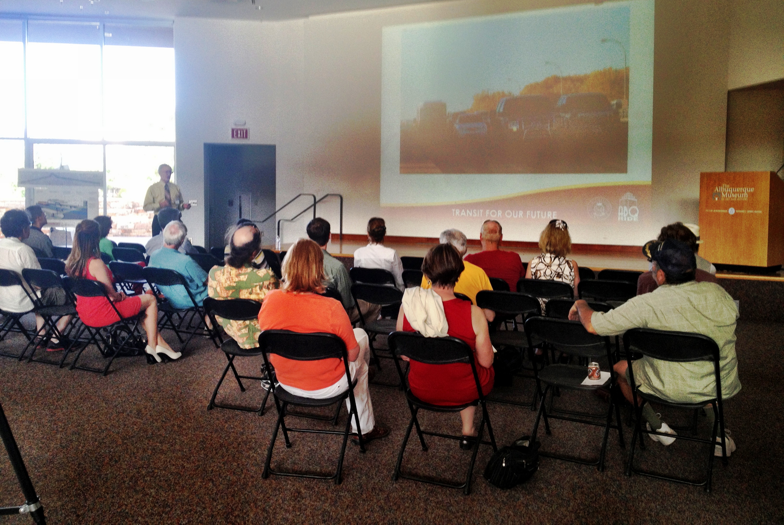
This brings me to the lessons of Dan Burden, people street specialist.  Thanks to the generous contributions from AARP, UNM, the Mid-Region Council of Governments and other partners, the Complete Streets in New Mexico Leadership Team hosted Dan Burden in Albuquerque on May 16-17.  His analysis focused on San Pedro Road and Constitution Avenue in the Fair Heights and Mark Twain neighborhoods.

Who is Dan Burden?

Dan is famous for several reasons.

  • Walking audits

The field of planning, or any field for the matter, is dominated by meetings behind closed doors in badly designed windowless buildings.  This environment leads to equally closed minds.  Dan throws all of that out the window, gathers everyone together and takes them on a walk.

On these walks, Dan uses the crowd to teach lessons.  For example, during our walking audit in the Mark Twain neighborhood, Dan used the audience to create a human traffic circle.  A car approached and drove around us, carefully and safely.  Lesson learned.  No long, complex jargon filled explanation was required.

A custom Dan Burden Human Traffic Circle, here in ABQ.  - Photo: Valerie Hermanson
A custom Dan Burden Human Traffic Circle, here in ABQ. – Photo: Valerie Hermanson

A Dan Burden walking audit is a form of street theater.  He is famous for throwing a tape measure into the street, disregarding oncoming traffic.  Dan does this to make a point, to teach a lesson and to draw attention.  He takes measurements in real time and explains why the design leads to bad behavior and points at actual observed examples.

What does this have to do with our local economy?

Let’s start with automobiles.

According to the Victoria Transport Policy Institute, regions with high level of automobile dependency experience economic detriments compared to regions with a more balanced transportation system (Source: page 6)

This is a point I have discussed in previous posts, especially in my article about Indian School: high speed traffic not only kills people, but it also destroys our local economy.

Regarding San Pedro, it is an economically depressed corridor in large part due to the ineffective and inefficient transportation infrastructure.  Mr. Burden proposed a solution.

  • Road diets
The blue line on this map highlights the segment of San Pedro which requires change.

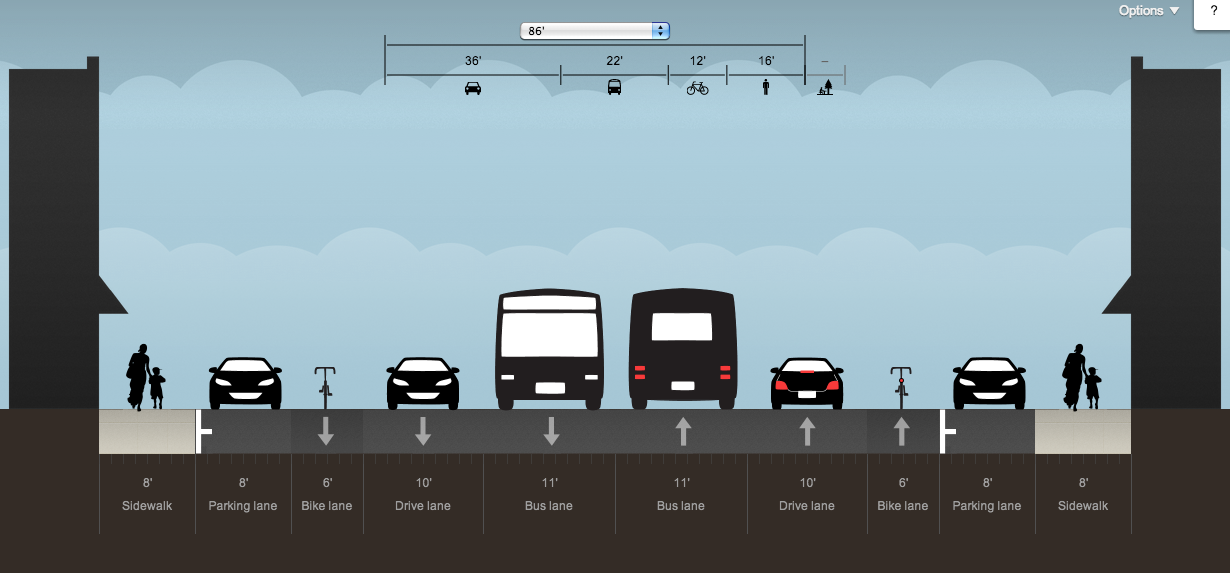
This is also a Dan Burden innovation.  It’s powerful because it only requires paint.  For the modest investment of $40,000 (~$15,000/mile, 2.5 miles, source: scroll to bottom of page), San Pedro can be redesigned with people in mind.

A road diet on San Pedro would take the current 4 high speed traffic lanes and convert them to 3 lanes + bikes lanes on each side.  One of the three lanes would be a center turn lane with opportunity to build medians and concrete crosswalk islands.

In addition, a road diet allows for safer and more efficient movement of automobiles.

This is a diagram of San Pedro today.  No bike lanes, narrow sidewalks and no easy way to make a left turn.
This is a diagram of San Pedro today. No bike lanes, narrow sidewalks and no easy way to make a left turn.

Here’s an example: Today, if a vehicle wants to make a left turn from San Pedro onto another street, they have to stop in the middle of traffic.  People behind them have to stop.  Sometimes, they aggressively switch to the right lane instead.  This leads to dangerous, high speed crashes.

Because of this bad design, it is difficult and dangerous to access businesses on San Pedro.

The most important thing to understand about a road diet: the stakeholders who stand to benefit the most are the business owners!  Some of the businesses owners on San Pedro are resistant towards road diets because they perceive them to be a “reduction in capacity”.  A road diet actually leads to an “increase in efficiency”.  Providing a center turn lane makes it far easier to both access businesses and move vehicles through the corridor.

Another benefit is a large reduction in speed.

Why is this so beneficial?

For Bicycles and people on foot: slower speeds = safer crossings and corridors.  A collision at a speed below 20 MPH is almost never fatal.  At 40 MPH, it’s almost always fatal.  A slower corridor is a safer corridor and a safer corridor leads to an increase in people walking and biking.

Notice how far people are walking from the curb in fear.  Vehicles frequently move at 50 MPH+ on this street, San Pedro. - Photo: Valerie Hermanson
Notice how far people are walking from the curb in fear. Vehicles frequently move at 50 MPH+ on this street, San Pedro. – Photo: Valerie Hermanson

For businesses: Dan Burden says that the ideal speed for a businesses district is 19 MPH.  At this speed, motorists have enough time to see a businesses, slow down and park.  This leads to local commerce and a more vibrant corridor.

This image shows how with the same amount of space, you can effectively move traffic and improve access for everyone.  Added benefit: the bike lane buffers the sidewalk from vehicle traffic.
This image shows how with the same amount of space, you can effectively move traffic and improve access for everyone. Added benefit: the bike lane buffers the sidewalk from vehicle traffic.

How can we, as a community, make the San Pedro Road Diet happen?

There are a few barriers to this project.  However, there is huge support for it as well.

SUPPORT: The Mark Twain and the Fair Heights neighborhoods are organized together in support of this project.  The Dan Burden event took place at Mark Twain Elementary School.  The principal of the school attended much of the workshop and he was very supportive of everything discussed.  The recently elected City Councilor for the area, Diane Gibson, attended as well.  She also stayed after the presentation to speak one-on-one to some of the louder voices of resistance in the room.

RESISTANCE: There a two primary voices of resistance against this project.  One of the voices is a collection of businesses owners along the corridor.  They feel that reducing vehicle lanes = reduction in traffic = reduction in businesses.  As we’ve read above, this simply isn’t true.  Luckily, this is a problem that can be solved through education.  It will not be easy but it’s certainly doable.

The other much louder voice comes from the City of Albuquerque Department of Municipal Development (DMD) – Traffic Engineering.  During this conference, we heard from the traffic engineers that a road diet on San Pedro was essentially impossible because of traffic counts.  They used the word “failure,” implying that changing the road in any way would cause the sky to fall.  In engineering language, the “failure” of a road means that traffic will come to a standstill.  The question I wish I had asked:

For what percentage of the day would San Pedro be in “failure”?  2 hours?  30 minutes?  5 minutes?

For most of the day, San Pedro is empty.  Based on what was said, the engineers intend to design a road that functions well for a small percentage of the day and badly for the majority of the day.  On top of this, vehicle miles driven (VMT) locally have been dropping steadily since the early 2000s and transit ridership locally has doubled in the past decade.  This trend will continue as our population ages and mass transit improvements are made.  San Pedro also has redundancy.  There are several parallel roads with space to absorb a few extra cars per day. This voice of resistance will be more difficult to defeat.  We as a community must work together to patiently educate and explain to these engineers that the decision to prioritize motor vehicles is destroying our community.  Adding safe bicycling facilities and reducing traffic speeds should be the top priorities for traffic engineers working on our local streets.  Luckily, according to Dan Burden, once a single road diet happens, the barriers crumble and they become common place across the community.

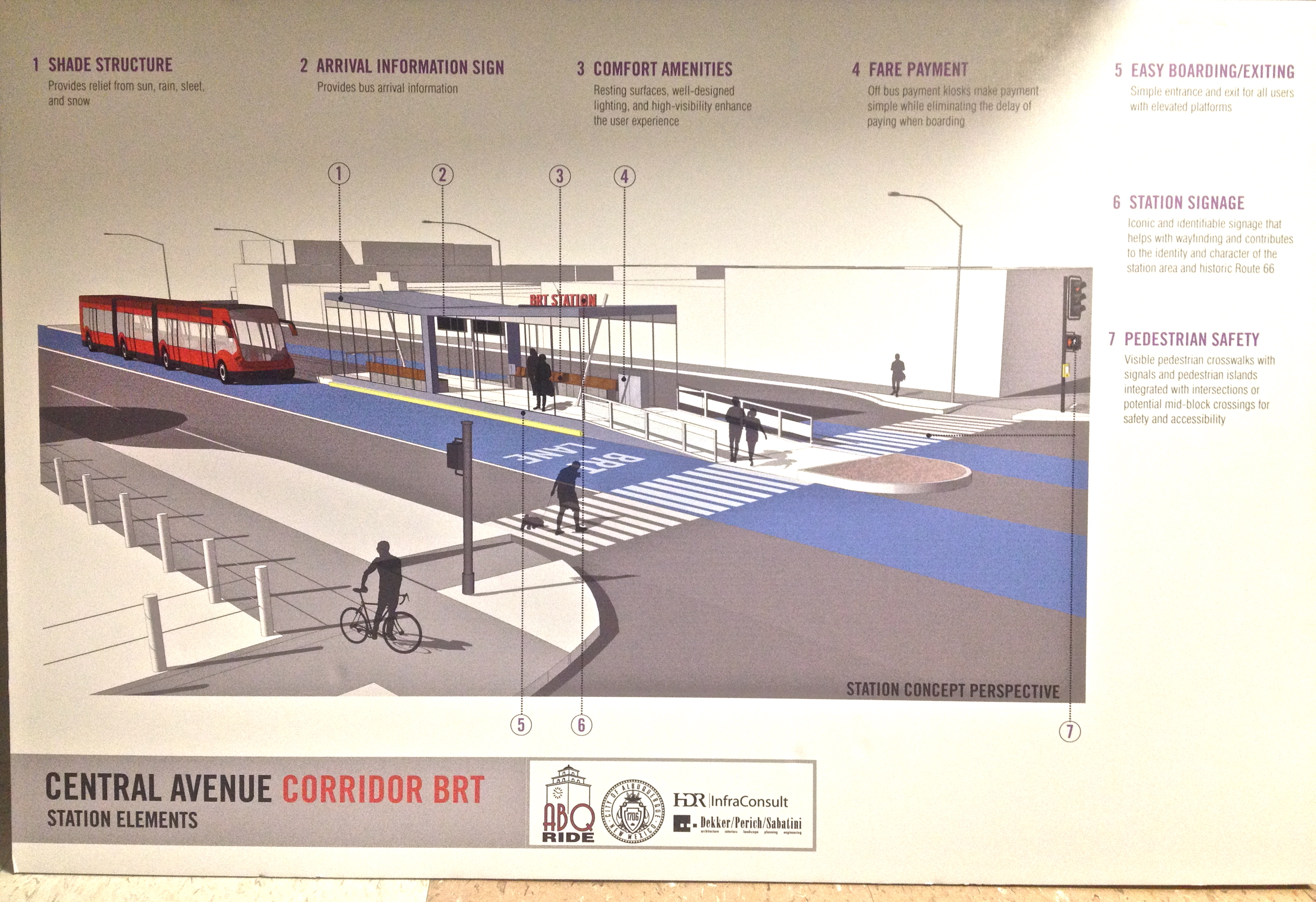
THE VISION: Below, is an idealized image of the Mile Hi District.  This is the historic name of the business cluster on San Pedro between Lomas and Constitution.  The name is the result of the elevation of this area being exactly a mile above sea level.  Restoring this historic brand will be an important part of reinventing this potential filled corridor.  Linked here are more redesign proposals for San Pedro.

The image below has it all: buffered bike lanes, nice buildings, wide sidewalks, on-street parking, etc.  The final product might not have all of these elements but we need to work as a community to include as many of these elements as we can.

THE CHANGE: It’s time to change how we think about transportation in our community.  We all gripe about how Albuquerque is a “car town” and this is the opportunity to turn things around.  If data is collected properly, this project could set the stage for a major transition in our community.  In a place with such temperate weather and 300+ days of sunshine, it is unacceptable that we are unable to walk or bike safely to most destinations.

What do you want to see on San Pedro?  This may look impossible or unrealistic but plenty of communities have accomplished projects like this.
What do you want to see on San Pedro? This may look impossible or unrealistic but plenty of communities have accomplished projects like this.

TAKE ACTION!  

Contact Councilor Gibson and tell her you support this action.  The squeaky wheel gets the grease.  If the support is more vocal than the resistant business owners, this project WILL happen.

Councilor Diane G. Gibson: dgibson@cabq.gov
Policy Analyst Chris Sylvan: csylvan@cabq.gov
Phone: (505) 768-3136

When an issue receives just 10+ emails or phone calls, it becomes a high priority one.  Send out links to this post to anyone who you feel could influence policy on this issue.

Thanks for reading and keep on pushing for positive change in your community.

A Better Block for Burque: Andrew Howard & Event Based Activism

-Dan Majewskibetter block logo

On October 21, Andrew Howard, one of the two people behind Team Better Block, visited Albuquerque.  Contact with Andrew was initiated through a tweet from Tim Trujillo which manifested into a visit through the efforts of many.  Former City Council Roxanna Meyers and the University of New Mexico School of Architecture and Planning both contributed money towards bringing Andrew to town.

Mr. Howard was brought in to look at various parts of urban central Albuquerque and identify a segment of town which is on the cusp of success but could use a bit of boost.

Watch the video below to see the work that Team Better Block does.

Meeting the Players

The morning began with a breakfast at Flying Star on Silver & 8th St.  Tim Trujillo, Rick Renne of the Downtown Action Team, Mark Childs of the UNM School of Architecture, Andrew Howard and I were present.

At breakfast we learned more about Andrew’s background and his experiences with H-GAC (the Houston, TX equivalent of MRCOG) and Kimley-Horn, a multinational engineering and planning consulting firm.  The public process he observed while working for these organizations was so discouraging that he decided to try something different.  This led to his collaboration with Jason Roberts and the birth of Team Better Block in Dallas, TX.

After breakfast, Tim, Rick and I gave Andrew a tour of some important portions of Downtown including the Gold Ave. Lofts, the Sunshine Block and the Alvarado Transportation Center.  Tim and I then directed Andrew around Barelas with a focus on the Railyards and 4th Street, including the iconic Arrow Supermarket.

Next on the list was EDo: East Downtown / Huning Highlands.  In EDo, Andrew told us he was looking for something more “gritty” and “authentic”.  In his mind, EDo has already “made it” (did you hear that Rob Dickson?!) and he wanted to see a place that hadn’t quite “made it” yet.

When Andrew made these comments, I immediately thought of the International District.  In my mind, it has the right bones which would allow it to become an “art district” of sorts.

However, the last area we had time for was North 4th / Mountain, including Marble Brewery and some of the warehouses in the area.

Lunch @ CityLab

Andrew Howard at CityLab

The next agenda item was a brown bag lunch hosted by Micheale Pride of the UNM + CABQ CityLab space.  Important local players in attendance included city traffic engineer Crystal Metro and Linda Rumpf who works for the Office of the Mayor and ABQ: The Plan.

We began with a short video about some of the recent work done by Team Better Block in Norfolk, VA.  After the video, people started to talk.  Sammantha Clark vocalized the difficulty of getting land owners to open up buildings for these types of events.  Andrew responded by noting that insurance for a Better Block event must be included as part of the price tag.  He says that owners tend to loosen up as planning for the event accelerates.  When landowners observe the momentum, minds change.  Mr. Howard also emphasized that with difficult property owners, you have to begin by just asking to get inside the door.  Don’t overwhelm them with event details immediately.

The discussion continued into debate about the parklet/parquito program which is currently being pursued by ReUrbanate ABQ.  We learned that Lobo Scooter “buys” the parking space in front of their store to display scooters everyday.  Who is to say we couldn’t do this for a parklet or some type of art installation on the day of the event?

Linda brought up the importance of Route 66 in regard to any proposal or plan.

I asked Andrew who we can look towards regionally for inspiration.  Andrew mentioned Denver but regarding a city our size, Fresno, CA was the best example he could think of.

Mr. Howard also told us about the Better Block experience in Wichita, KS.  Wichita is home to the infamous Koch Brothers, wealthy contributors to ultra conservative think tanks and organizations.  Needless to say, Wichita is relatively conservative and resistant to change.  Despite initial resistance, Better Block was successful in this community.  The success was due to a data driven process where economics became a major emphasis.  A major function of Better Block is creating opportunities for commerce where there previously were few.  Mr. Howard emphasized the importance of a data driven process when there is resistance.  My favorite quote from Andrew regarding the current state of the mandated “planning process”:

I don’t think the next generation is going to put up with it.

The International District was brought up when Michaele informed the group of the place-making process occurring in the district.  Little Globe, UNM, AMAFCA, CABQ and many others are collaborating on place-making through art in this historically poor and ignored segment of the city.  Michaele also explained how East Central Ministries is a major umbrella for positive grassroots advocacy efforts in the International District.  They are planting seeds for a better future in the area.  Andrew’s presentation later that evening featured a similar organization in a poor part of Dallas which led a successful Better Block effort.  The pictures reminded me of the International District.

The Better Block Timeline

Jason Roberts of Team Better Block in action!

Per my request, Andrew broke it down.  He referred to the process as “part chaos, part faith”:

3-4 months – develop a plan.  In order to make it viable, there MUST be a strong a champion from the area to push it forward.  1-2 major property owners on the block must be on board.  At the same time, set a date and publish it!  Andrew emphasized the need to “blackmail yourself”.  It forces people to commit.  The corridor should have a design speed of 25 MPH or less.  That’s the threshold speed for a successful project so on the day of the intervention, create a streetscape that has these design speeds.

1 month  – Begin the pop-up shop application process.  Initiate walk thru of the buildings you want to “occupy” on the day of the event.

2 weeks out – Begin the pre-build.  Acquire materials, talk to players you want involved, hash out the details.  Clean up the retail spaces and ready them for occupation.

2 days out – Full build out of the occupied spaces.  The idea of doing it at the past minute means no procrastination is allowed!  With 4-5 hours and lots of volunteers, it will happen.  More people involved = less time needed for build out

Day of – Start early and get those boots on the ground.  The rest can only be determined by the community.

1 month after – Show up at City Council with a list of local zoning codes you broke in order to make the event happen.  Come to them with stats about the success of the event, how great traffic calming is, etc.  It will be a hard argument to reject.

City Staff Meeting

City staff meeting.  The book in the foreground is a report from a successful project in Norfolk, VA.
City staff meeting. The book in the foreground is a report from a successful project in Norfolk, VA.

The next agenda item was a meeting with members of city staff.  The diverse group of attendees included, but was not limited to, Andrew Webb, Roxana Meyers and Russell Brito.  

Regarding the success of doing a Better Block project, Andrew emphasized the importance of champions vs. cheerleaders.  In the Better Block project area, there must be someone who is passionately interested in the potential of the neighborhood.  A cheerleader is extremely supportive but a champion will live and die for the block.  The best example of a champion in Albuquerque is Rob Dickson.  His unwavering passion for the creation of a stronger East Downtown (EDo) has led to a successful transformation of Central between Broadway and I-25.

Another element of a successful Better Block is a 50/50 mix of vitality and abandonment.  Selecting a completely decrepit area is not recommended.  You need people occupying a given area (a block “anchor”). These existing tenants see the potential for the block and are therefore generally supportive of the event.

Mr. Howard also explained the most importance part of the Better Block process: the 30 days after.  In those 30 days, data and information must be processed and presented to city staff.  It is generally presented with zoning change recommendations.  At the first Better Block, Jason and Andrew had giant posters in the windows of buildings explaining which rules were broken to create the Better Block!  When city staff saw these posters, a positive community conversation began.

Eventually, the talk turned to Downtown and why it has struggled over the years.  Andrew went around the table, asking each person a question which then led to another question for the next person around the table.  Andrew concluded by asserting that Downtown struggled because it was not treated like a neighborhood.

We then discussed a variety of other items such as the difference between a special event vs. a pilot project vs. a permanent project.  Mr. Howard also emphasized the importance of keeping the scope of Better Block small in order to make it successful.

In this meeting, we also learned about a strong relationship between Better Block and the National Association of Realtors.  It has facilitated multiple successful Better Block projects.

The Big Event

In the evening, Andrew presented his story to a relatively full house in the Garcia Auditorium @ George Pearl Hall, UNM S-AP.  Michaele and I explained to the audience the process of getting Andrew here and then let him do the rest.  For me, it was the least exciting and most relaxing part of the day.  At the same time, it was good opportunity to reflect upon the conversations we had over the course of the day.

Some highlights from the evening presentation:

  • Context sensitive design: be conscious of the place you are designing for.
  • Duct tape: the most important tool in the toolbox.  Temporary can be powerful.
  • Think SMALL!
  • Break all of the rules and do it publicly!  Make sure people know which rues you are breaking.
  • Better Block is fun but it is NOT a party.  Collecting data = potential for long-term change.
  • Tell the story of the place.  Every place has talent and resources.  Sometimes, the place just needs to be looked at differently / appropriately.
  • Connect the dots.
  • Build trust.
  • The world is a stage and Better Block is an act of improv.

After the presentation, Mr. Howard walked into the audience and conversed with many of the attendees.  Many of us left the presentation fired up and filled with ideas.

Mr. Howard left Albuquerque, NM the next day to speak at a conference at MIT.


What’s Next + Andrew’s Top Choice for a Better Block in Burque

After seeing many parts of town, Andrew selected a street for the first Burque Better Block:

Gold Ave. Downtown between 2nd and 4th.

The built environment on the select segment is ideal: good building stock + high level of occupation + some vacancies.
The built environment on the selected segment is ideal: walkable building stock + healthy mix of occupation and vacancies.

This segment of Gold is also the proposed location of the first parklet/parquito in Albuquerque.  There are plenty of natural partners on the segment, including Café Giuseppe.  The right of way is 55 ft.  It allows for the possibility of using the street differently.

CiQlovia: Coming September 2014

Regarding the first Burque Better Block project, I am planning a larger event.  I have begun the planning process for a ciclovia/open streets event in Albuquerque.  It will be called CiQlovia (Q for ABQ) and it will incorporate elements from Team Better Block.  At this point, the draft route includes Silver but we are looking at using Gold instead so we can have Better Block elements integrated into the event.

Currently, my team and I are in the early stages of the planning process.  We have selected a draft route, pictured below, and and we are aiming for one of the four Sundays in September.  It includes Downtown, Old Town, Barelas, the Bosque and other amazing neighborhoods in the historic core of Albuquerque.

This map highlights the proposed route as well as land uses along the route.

We Need YOUR Help!

CiQlovia will require a massive team of volunteers as well as funding.  Once we acquire our special event permit at the beginning of the year, we will begin seeking out members of our community who would like to be involved.  We are looking for food trucks, yoga teachers, natural healers, philanthropists, artists, muralists, craftspeople, bicycle repair experts… well, let’s just say this will be like nothing Albuquerque has ever seen.

Supported by the Complete Streets New Mexico Committee, the Healthier Weight Council, the Downtown Neighborhood Association and the City of Albuquerque, CiQlovia will promote the use of our streets, our largest public space, for something other than moving as many automobiles as possible.  Streets are closed in Albuquerque for races, parades and shopping events.  CiQlovia is about just being in the street.  It is about providing a safe place for people to walk, bike, rollerblade and exercise, fresh air.  More than anything, it is a statement about the relationship between our built environment and the obesity crisis.

Keep following UrbanABQ.com for updates on this event.

See you there!

Jeff Speck + Jefferson Middle School: Improving a Problematic Proposal

– Dan Majewski

Click this image to visit HaltTheLoop.com

NOTE: Jefferson Middle School may soon fall to the bulldozers and a loop road will be constructed around the school. This proposal has been pushed through without any public process. If you have an interest in learning more about this issue or preventing it from happening, click the image above to visit HaltTheLoop.com.

On the evening of August 14, the renowned urbanist and author Jeff Speck lectured at the Hotel Parq Central. The attendees were a diverse mix of community members including city planners, developers and other interested citizens. Mr. Speck’s ability to speak candidly about the issues facing Americas urban communities was refreshing and helpful. His new book, Walkable City, outlines in detail many of the themes highlighted in his presentation. If you are interested in making Albuquerque or any city more economically sustainable and physically healthier, I strongly recommend this book. It is light on the jargon yet it clearly highlights the ingredients necessary to create cities for people.

Mr. Speck Goes to Jefferson
The next morning, I joined Jeff Speck and a couple of other community members on a tour of Jefferson Middle School. The discussion topic was a proposed loop road around the perimeter of the school. I previously wrote an article about this issue titled Why Don’t Children Walk to School Anymore? Crisis and Opportunity at Jefferson Middle School.

We arrived at the school around 8:10 AM during the peak of the morning parent drop-off rush. It was relatively tame on Girard: slow speeds, minor congestion and relatively fluid movement. Once we entered the adjacent neighborhood, the issues became more visible with high volumes of parent drop-off traffic observed. This created potentially dangerous situations for the many students and residents walking or biking on these streets.

We parked and entered the school grounds from one of the three walking paths which connect the neighborhood to the school. The loop road plan was briefly explained to Jeff and as we walked he began to draw.

Mr. Speck observed that there was very little traffic on Lomas considering it was the peak of morning rush hour. Sure enough, the traffic counts show that this segment of Lomas is overcapacity and does not need three lanes in each direction.

Lomas could easily lose a lane between Carlisle and Girard

For comparison in the image above, observe that Central, highlighted on the bottom of the image with a black rectangle, handles almost twice the amount of traffic (31,200 cars/day) between Girard and University with only two lanes in each direction. I encourage you to play with the large full version of the traffic count map in the image above: 2011 Traffic Flows for the Greater Albuquerque Area.

In just 45 minutes, Mr. Speck quickly sketched out three alternatives to the loop road which were far superior to anything presented by APS. They are as follows, beginning with least expensive/physically easy and ending with most expensive/physically difficult:

Click to enlarge!  This image illustrates the conversion of the existing right lane into a pick-up / drop-off lane
Click to enlarge! This image illustrates conversion of right lane into a pick-up / drop-off lane

OPTION A: Blub-Out on Lomas = Traffic Calming, Lower Speeds
This plan would be both incredibly cheap and physically easy to implement. Regarding physical infrastructure, it would only require a bulb-out (COST: ~$20,000; source) and pavement markings instructing vehicles where to stack, where to turn, etc. Compare this to the cost of the proposed loop road at $572,000. The graphic above explains Option A in detail. As written in the graphic, this segment of Lomas only averages 17,400 cars/day! This volume of traffic could easily be managed with only two lanes vs. the existing three lanes.

A major side benefit of this plan would be reduced speeds and traffic calming. One less traffic lane would give vehicles one less opportunity to pass aggressively, making it safer and easier for people to cross the street.

Click to enlarge!  Speck's sketch of Options A and B
Click to enlarge! The J. Speck sketch of Options A and B
Click to enlarge!  This image shows the space available to enlarge the existing bus drop off area
Click to enlarge! This image shows the space available to enlarge the existing bus drop off area

OPTION B: Extended Bus Drop-off Lane
According to neighborhood residents, Lomas is only serviced by four school buses. However, the bus lane is wide and if extended, could easily handle the existing four buses as well as a significant percentage of the parent pick-up/drop-off traffic. The graphic above explains this alternative in more detail. Since this option would involve extending something that already exists, the cost to build it would be much lower than the proposed loop road.

Click to enlarge!  In my rough illustration, the red rectangles represent the enhanced crossings proposed by Jeff Speck.  A tree lined sidewalk skirts the outer edge of the project area
Click to enlarge! In my rough illustration, the red rectangles represent the enhanced crossings proposed by Jeff Speck. A tree lined sidewalk skirts the outer edge of the project area

OPTION C: Tree Buffered Loop Road + Enhanced Crossings + Narrowed Pavement
This option, pictured above, would require the least amount of deviation to the existing plan. However, the enhancements discussed here would lead to a much higher quality project.

The image below was drawn by Mr. Speck. In his drawing, the proposed 24 ft. road has been transformed. Mr. Speck proposed:

12 ft driving lane +
8 ft. gravel parking lane +
6 ft. tree buffer +
6 ft. sidewalk +
6 ft. tree buffer

Click to enlarge!  The right side of this image, drawn by Speck, details proposed new alignment
Click to enlarge! The right side of this sketch by Speck details the proposed new alignment

A 12 ft. driving lane plus an 8 ft. parking lane vs. the proposed 24 feet of pavement would mean lower speeds plus less storm water drainage issues.

The tree lined sidewalk would both reduce the heat island effect of the new road and provide a pleasant walking environment for the significant percentage of students who walk to school.

Another critical element of the Speck plan is raised crosswalks at all three of the neighborhood pedestrian cut throughs plus the two ends of the road. Below is an illustration of a raised crosswalk:

A hybrid crosswalk and speed table, raised crosswalks are a great way to slow down traffic and provide safe crossings

Creating Places for People
Jeff Speck saw the issues at Jefferson Middle School and quickly found cheap, easy and reasonable solutions to the current problem. Regarding Option A, Jeff Speck made this point:

If we think in isolated boxes, we are fixing a school drop off problem by creating a traffic problem. If we think synthetically, we are fixing two problems at once: school drop off and an unsafe sidewalk against speeding traffic.

This project is interesting because of the larger context. APS is one of the most influential organizations in the City of Albuquerque. If they do not have an interest in encouraging walkable environments around their schools, the whole city loses. Regarding walkability, schools and children are the lowest hanging fruit. By design, most student live in close proximity to their school, especially if it is a middle school or an elementary school. Encouraging walkability is simply good economics: parking lots and loop roads are a lot more expensive than crosswalks and bike lanes.

Jefferson Middle School has a history of students walking and biking to school. Though a significant percentage of students are now attending from outside the district, there is still plenty of opportunity to encourage walking and biking.

Since APS does not have to answer to any higher authority, they are acting in a disrespectful manner. They refuse to acknowledge all of the better options that could be used to solve the parent drop-off/pick-up problem. They want the project to be completed and for the neighbors to get out of the way.

The city has not yet granted the curb cut that Jefferson/APS needs in order to complete the road but the writing is on the wall. Within the past couple days, fences and other infrastructure have been placed, suggesting an imminent start to this project.

It is unfortunate that APS does not want to build a good relationship with its neighbors. It is a missed opportunity and it will leave behind bad blood in the neighborhood for years to come.

TAKE ACTION!
Come to the Albuquerque City Council meeting tonight (August 19) at 5 PM and speak up for progressive walkable urbanism in Albuquerque!

CicLAvia and the New Los Angeles: Lessons for ABQ from the City of Angeles

– Dan Majewski

Overlooking the 110 Freeway, Wilshire Boulevard

IMAGINE: Central Avenue, from the Rio Grande River to San Mateo, completely closed for an entire Saturday or Sunday.  Open lots filled with stages and music.  More bicycles, rollerblades, long boards and strollers than you’ve ever seen in your life.  People lying in the middle of the street on a mattress.  Tall bike riding leotard-wearing youth.  Old Route 66 transformed into New Route 66, a street for people.

Try to count the bikes!

The equivalent of this happened in Los Angeles on Sunday, June 23.  Six miles of Iconic Wilshire Boulevard, the traffic and exhaust choked historic Main Street of Los Angeles, was closed to motor vehicles from 9 AM – 4 PM.

Streets filled with people, Downtown Los Angeles

What is CicLAvia?

The concept is simple:

1)    close the street to vehicles

2)    bring in food trucks, live music, yoga teachers, etc.

3)    make sure all of the businesses along the route are open

4)    see what happens!

It is based on ciclovia, a tradition that began in Bogota, Columbia three decades ago.  The concept is now rapidly spreading across the United States and other parts of the world.  Tucson, a city with many similarities to Albuquerque, is now planning its sixth event.  An estimated 25,000 people attended the most recent event in April.  Read about my experience at the first Tucson ciclovia here.

Los Angeles first tried this experiment on 10/10/10.  The route utilized side streets that normally had little car traffic.  It had public support but many a naysayer.  After all, modern Los Angeles is practically defined by car culture.  Los Angeles is world renowned for soul-crushing traffic jams, a massive freeway system, fancy celebrity filled Ferraris, Jay Leno’s car collection… you get the idea.

Despite the doubt, the inaugural CicLAvia was a huge success100,000 people huge.

Map of the first CicLAvia event

Where is CicLAvia Now?

There will be three CicLAvia events on the streets of Los Angeles in 2013.  It has a vast array of financial supporters and local champions as shown in the photo below.

Banner displaying a portion of the major contributors to the most recent CicLAvia event

The event on June 23 was incredible.  The route itself included many famous buildings, museums and public spaces best seen at the speed of a bicycle or slower.  For the first time “dismount zones”, where people on foot were prioritized, anchored each end of the route.  It marked a welcome change in policy since the goal of CicLAvia is to open the streets to ALL non-auto users, especially people on foot.  The fact that this route was shorter than previous routes also made it easier to walk the entire distance.

Read more about the event here and here.  The official CicLAvia website can be accessed here.

Los Angeles, 2013
Los Angeles, 2013

The New Los Angeles

As someone who was born in Los Angeles and visits frequently, there is change afoot.  The Southland is truly beginning to shift its policy and funding priorities towards transit, cycling and walking.

Los Angeles, up until 5 years ago, barely had a bicycle plan.  It had little official acknowledgement of bicycles as either a form of transportation or a way to get some exercise and fresh air.  The big shift occurred when the outgoing mayor, Anotnio Villagrosa, was hit while riding his bicycle on Venice Boulevard in 2010.

Suddenly, doors opened.  It’s unfortunate that it takes a crisis but it’s incredible to see the progress since.

Los Angeles is only one of many cities in the region currently transforming its streets.  Long Beach and Santa Monica, both of which will be written about in future posts, are currently the leading the progressive urban awakening in Southern California.

Cities Are for People

The era of car dominance will be looked back upon as an odd blip in human history.  For all of time until the past 75 years, every human settlement was built around the person on foot.  Even when railroads and streetcars were invented, the city continued to retain this focus.  After all, one has to walk to the streetcar station or the railroad depot.  It is only with the advent of highly subsidized fossil fuels that our urban areas have shifted into sprawling behemoths connected by 15 lane super highways and dominated by automobile.

Los Angeles is THE poster child, the ultimate symbol for a new direction, a new future, a new hope.  With two rail transit lines under construction and three about to break ground, the people of SoCal have voted for a future where one can ride a bicycle safely on the streets of Los Angeles for more than one day a year, where you don’t need a car to get everywhere, where walking is a reasonable and safe way to move around the community.

A map of completed and under construction Metro rail lines

Central Avenue and Wilshire Boulevard: Creating a 21st Century Corridor

Central Avenue and Wilshire Boulevard are two urban corridors experiencing similar transitions.  Wilshire recently received designated bus priority lanes.  It (like Central) has more transit riders than any other corridor in the city.  Plans have been approved for rapid transit on the corridor.  However, it will be located underground, providing the city with an opportunity to reshape the streetscape dramatically.

On Central Avenue, an underground transit system makes little sense based the population of our region.  Our options at this point are to do nothing, bus rapid transit (in any variety of shapes or forms), light rail, streetcar or possibly a combination of all of the above.  Each segment of Central has a slightly different need and this needs to be acknowledged.  This community conversation is beginning to bear fruit but it is missing something: a larger regional vision.

The Need for a Regional Vision

Los Angeles is moving forward so rapidly because it developed a regional vision.  In 2008, the people of Southern California voted for a tax increase called Measure R to fund improvements in transportation around the region.  They are not the only metro area which has done this; Tucson also voted on a similar (but much smaller) proposal in 2006 called the Regional Transportation Authority.  All over the country, metropolitan areas are voting not to wait around for the federal government.  They are deciding to work together to develop a vision for the future of the region.  These movements are both bottom up and top down.

Here in Albuquerque, we recently voted to allocate local bond money to be spent on the Paseo del Norte interchange.  This project on its own is not necessarily a bad thing.  However, the fact that it was approved in isolation is a disturbing trend.  Will we continue to just vote on individual projects as needed?  This is a terrible strategy.  The PDN interchange should have been part of a larger transportation improvement package.

A rendering of the proposed improvements to PDN

The advantage of a package is projects which would not necessarily be supported independently can be funded when combined with other more popular projects.  Also, it allows everyone to get a piece of the pie.  For example, the Los Angeles funding measure allocated different percentages of the tax to different pieces of the transportation puzzle: 20% to bus operations, 20% for highway capital projects, etc.

An example from Albuquerque could be 20% for BRT, 10% for Rapid Ride, 5% for protected bike infrastructure, 30% for Paseo del Norte, etc.  The options are limitless and putting it all together results in a strategy and a vision.

ABQ 2020

In order to progress economically as region, we need to develop an infrastructure investment package.  We need to work together to find out which projects are most important, how much they will cost and how they can be a part of developing a 21st century economy.

I will be explaining the specifics of my proposal in a future post.

Thank you for reading and please comment below!

Central Avenue: The Necessity of a Strong Vision, Community Champions and Street Trees

UPDATE 2/4/16: Last night, the City of Albuquerque hosted a meeting about this BRT project on Central, now called ART. See the project website here! Many new and updated features of the project were unveiled at the meeting including pedestrian scale lighting along the entire project corridor and FREE high speed WiFi!

We will be learning if ABQ receives the federal grant for this project in less than 1 WEEK, on February 9th!

Many people believe project has been “fast tracked” without any public input. Part of why we’re reposting this article from 2013 is to disprove that point. Also, many of the concerns voiced in this article have been addressed including:

Bikes and Silver: The City has planned and begun allocating funding for improvements to Silver. This does not mean that Silver will extend past the freeway. However, the city is also going to be making major improvements to bike facilities on MLK, already a heavily used bicycle corridor that connects UNM to Downtown. We still believe that there are unanswered questions about bikes on Central but overall, many improvements to the plan have been made.

Medians vs. Wider Sidewalks: The folks in Nob Hill came to an agreement with the project planners and there will be wider sidewalks through Nob Hill instead of medians, a huge improvement for the business district. In fact, sidewalks will be widened and improved throughout much of the corridor and pedestrian scale lighting will be added throughout the entire corridor!

Marketing, Outreach and Champions: This project has found a champion in the form of Mayor Berry.

However, outreach and marketing by the City on behalf of this project has been too little, too late. Unfortunately, outside sources have spread misinformation about the project. Independent from those outside sources, there has been resistance to the project for a variety of reasons. In addition, it is not always easy to communicate the benefits of this project, the construction process, the potential impacts and other aspects of this proposal.

The people running this project, as of very recently, finally starting using a Facebook page to communicate information. The City needs to do better promotion and outreach for these types of projects to get ahead of any possible pushback or misinformation campaigns. It’s not an easy thing to do but it can be done.

There’s plenty more to be said about this project and we will continue discussing it on our Facebook page.

The original article, in it’s unaltered form, is below:

“Central Avenue: The Necessity of a Strong Vision, Community Champions and Street Trees”

-Dan Majewski, May 2013

BRT meeting, ABQ Museum

During the month of May in 2013, the City of Albuquerque held six public meetings about a proposed Bus Rapid Transit (BRT) system for Central Avenue. Every meeting was held in a different location and focused on a different segment of the proposed project.

The format of the meeting was as follows:

  • 15 minute power point presentation about BRT + benefits of the project + why it should be built
  • 30 minute collaborative work session: we broke into small groups and conversed with consultants about what we like on the corridor, what we don’t like, what type of project alignment we would like to see, etc.
  • 15 closing presentations by each of the small groups

The collaborative element was useful. It allowed us to effectively express our opinons and hash out a vision for the corridor. It was also an opportunity to air grievances without having to interrupt the larger group presentation.

Bus Rapid What?

BRT Rendering

I attended two of these meeting and came away with mixed feelings.  BRT could be a great solution to the current transportation problems currently found on Central Avenue but it must be marketed correctly and executed properly.  Scroll to the bottom of the article for my full reaction.

Sorry, No Bicycles Allowed

For rapid transit systems to work, they must attract people from a wide geographic area.  To accomplish this, bicycles can be a great tool.  When asked about bicycles at this meeting, many of the consultants or city leaders implied that bicycles do not belong on Central Avenue.  “Why not the Silver Bicycle Boulevard?  Or MLK?  Or Lead/Coal?” they would say.  My response:

  1. Silver is great… until it dead ends at I-25.  It does not connect the University of New Mexico to Downtown, Old Town or the Bosque Trail.

    As you can see, the Silver Avenue Bicycle Boulevard ends at the interstate.
    The blue line on this map is the Silver Avenue Bicycle Boulevard. As you can see, it currently ends at the interstate freeway on the left side of this image.
  2. Most of the desired destinations are located on Central.  I may use Silver for 90% of my trip.  However, since my end destination is located on Central, I need to bike on Central for at least a block or two.  This means riding on the sidewalk (dangerous/illegal) or in the street (terrifying).
  3. Whether you like it or not, there is already a lot of bicycle traffic on Central.  It will only increase over time as this corridor becomes more dense.
  4. Accommodating bicycles does not necessarily mean 6 foot bike lanes in each direction.  It simply means providing infrastructure where possible.  This is an example of what bicycle accommodation could look like in the narrow segment between University Boulevard and I-25:

central

The Nob Hill No

The Nob Hill Neighborhood is the most organized and wealthy stakeholder group on this corridor.  They are also the most frustrated and angry about this proposal.  From their perspective, CABQ is trying to take away something (the medians) which presently provide safe pedestrian refuge.

True BRT = one general traffic lane in each direction.  This would lead to slower traffic speeds, creating a safer pedestrian environment and reducing the need for median pedestrian refugees.  However, the city has not adequately demonstrated the exchange of the medians for a world class rapid transit system.  The project leaders have not clarified how many crossings for people on foot would exist along the segment.  Also, it appears to Nob Hillers that this system will simply be going through the neighborhood without stopping (as the current alignment exists).  CABQ and ABQ Ride are not effectively selling the system to the neighborhood.

The city should explain that instead of the medians, Nob Hill could get wider sidewalks or bicycle lanes.

Using Streetmix, here’s how the Nob Hill segment currently looks:

Streetmix: nob hill current

Here’s how this segment could look with bicycle lanes:

Nob Hill, bike lane option

It could also look like this, replacing bicycle lanes with wider sidewalks:

Nob Hill; BRT + street trees

There are many potential positive possibilities.

Lessons from Ft. Collins, CO

On February 21st, the ULI (Urban Land Institute) hosted a full day conference about BRT in Albuquerque called Transit and Place: First Steps.  The day was filled with fantastic presentations from transit providers and developers nationwide.

Kurt Ravenschlag from Ft. Collins, CO delivered a wonderful presentation about the Mason Street Corridor BRT Project.  Initially, the project did not go over well in this mid sized college town.   It was rejected by the business community because the city was not emphasizing the economic benefits of the project, such as increased values around the station areas.   The transit provider was forced to go back to the drawing board.  The re-marketing of the proposal was successful and the project is now being constructed with major local support.

The City of Ft. Collins did not change the project!  They only changed the sales pitch.

All Together Now

The City of Albuquerque is currently working on a Complete Streets Plan for Central Avenue between 1st St. and Girard.  Isolated from the BRT project, this plan has its own webpage, a separate set of public meetings and different group of consultants.

This needs to change.

The BRT plan and the Complete Streets plan are the same thing!  They both have the same vision: increased economic development and a safer more beautiful street for people moving throughout the corridor.  Why are there two separate plans?

Mr. Ravenschlag from Ft. Collins emphasized the importance of first laying out a vision for the corridor.  Streetscaping should be the first conversation, followed by zoning overlays and bicycle/pedestrian access.  After all of that, transit should be discussed.

Reframing the Conversation

Central Avenue is in desperate need of a solution.

Half of all transit trips in the city are on this corridor.

It is Albuquerque’s main street but it is marked by vacant lots, visible poverty, fast moving automobile traffic, high pedestrian fatality rates, unsafe intersections and a lack of cohesiveness.

Rapid transit will be a part of the solution but it can not come at the expense of all the other elements.  Wide shaded sidewalks, bicycle infrastructure, rezoning of the corridor, reduction of parking minimums and safe pedestrian crossings at every intersection are all more important to the long term success of Central Avenue.

This project needs a stronger emphasis on the complete streets and economic development elements of the project.

ABQ Ride and the City of Albuquerque need to go back to the drawing board and figure out how to sell BRT as a larger part of the revitalization of the Central Avenue corridor.

The sales pitch could be something like this:

IMAGINE… an improved Central Avenue, Albuquerque’s Main Street.  Envision wide, smooth, safe sidewalks shaded with large native street trees.  Think of slow moving vehicle traffic and narrow, easy to cross intersections.  Visualize vacant lots disappearing, then filled with shops next to the sidewalk and apartments above.  Feel the warm summer air as you leave your apartment and walk a few steps away to a rapid transit station.  The station has shade, real time arrival information and other amenities.  However, you barely have time to look at all of it since a transit vehicle arrives every five minutes.  The successful vibrant Albuquerque of the future is linked to this critical corridor.

Can you see it?  I sure can.  For it to manifest, it will take strong local champions and a chorus of voices demanding a safer, more prosperous and more beautiful Albuquerque, a city for PEOPLE, where motor vehicles are guests.

It’s a difficult challenge but it’s our best hope for long term economic vitality.

Get involved!

Please comment below if you have questions or comments about this post.

For more information on the Central Avenue BRT project, click this link.

For more information on the Central Avenue Complete Street Plan, click this link.

Like the Complete Streets in New Mexico Facebook page for more news and information.

Like UrbanABQ on Facebook for more news and information.